
Routes
Route 5: Dénia - Els Poblets - El Verger - Beniarbeig - Pamis - Ondara - Dénia
(Page 2 of 2)
Itinerary
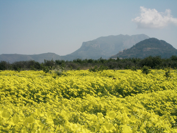 Fields in spring with the Montg".After visiting Dénia, to begin our route we head for the "CAMPSA" gas station located at the city exit towards Ondara. A dirt track on the right is what only remains of the Dénia-Carcaixent railroad design, dismantled in the 70's. A few signposts from the time can also be admired.
We set our distance meter to 0 and we start. At the end of the street (0.19) we will see a stop road sign, we will climb down the ramp to the right to immediately turn left. We reach a roundabout (0.56) and continue behind shop "Don colch"n". After passing a few industrial premises, we will soon find ourselves surrounded by orchards. We will pass in front of the Francisco Merle gardens on our right (1.69), one of many farms from this noble family, owners of the Marqués de Cáceres winery. 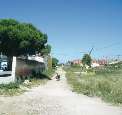 Start of the route.The stately XIX century house has a number of beautiful towers lending the construction a castle-like appearance, considered as a Building of Cultural Interest along with the nearby raisin storage house. We cross a small canal (2.27) and continue left, ignoring the road leading to restaurant "Tossal del Carmen". We will reach a junction on the road with a palm tree in the middle (2.53) and proceed right. Farther on, the road turns into a slight slope up, after which we will arrive at a rural place known as "El Tossalet" (small hill in Valencian) where we find a group of houses, some of them painted with colours that still preserve the traditional look, with gardens, wells and stone walls. We continue right on the road of "Assagador de San Pere" (3.11), at the end of which (3.84) we will turn left. We will arrive at another motorway (4.26) and get across it, following the sign indicating "CB Xaloc". At the next stop road sign (5.14) we find ourselves in "Assagador del Palmar", where we are to proceed straight on. Further on, we will see on our left the well-known estate of Finca Moya (6.10) where one of the best pine groves in the zone is found. The reedbed before us is an indication of a stream (the Alberca river) that we will cross shortly after at a ford that can get flooded during rainy weather.
 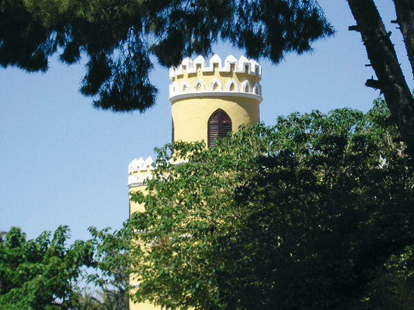 The Francisco Merle Garden.We proceed through a very rural stretch with farm houses and some abandoned orchard fields. Continuing straight, we reach another motorway (6.78). We will take to the left, following the signpost to Ondara for about 100 metres and then turn right to continue along another asphalted road. Each moment we get closer to the mountains of Sierra de Segaria, and the houses of El Verger can already be seen. Right above them, with some imagination can we perceive on the mountain the silhouette known as "Cara del Indio". At the end of this road (8.19), on finding ourselves before a beige house, we will turn right towards "Els Poblets". At the second stop road sign (8.86), we are on "Carrer Sant Josep" but the signal forces us to turn left. At the roundabout we follow the "Ajuntament" sign and after crossing the Girona river, we will reach "Plaza del Salvador" where its namesake church is found (9.07). If we wish so, we can visit the town from here (stop the distance meter). To resume the route, we follow the sign to El Verger on "Carrer Pego".
 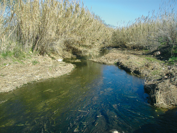 The Alberca River.At the end of this short street we turn left (9.10) and then, in spite of an arrow forcing us to the left, we will turn once more to the right at the end (9.18). We go around the Girona river bed and enter El Verger by turning right (9.50) at "Avinguda Lope de Vega" onto the City Hall plaza with its magnificent fountain. At the stop sign (9.63) we will continue left along "Carrer Mol’" into Plaza Mayor (9.77), from where we can visit the town. To resume the route, we will ask for the "Menut Llevant" bar, located at the corner of the "Carrer Calvari" national motorway. At the end of this street there is a cemetery, behind which we take the paved road to the left (10.30) running along the cemetery wall. A little further on, we are to ignore the road on the right (11.05) and continue straight along a small ramp, then turn right at the end (11.43) and pass under the national road and beneath the motorway (11.59). From here, an extra option would be to visit the Segaria Park (stop distance metre), for which we must continue straight about 800 metres. On this stretch, however, we will face some short yet steep climbs.
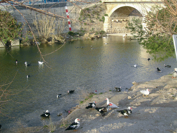
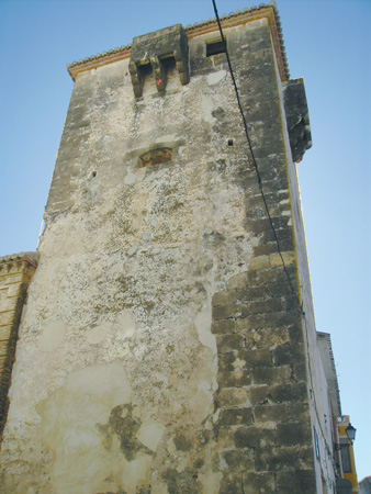 Tower of Cremadilla. El Verger.With barbecue areas, lodging cabins and toilets, Segaria Park is an ideal place to spend the day. From here we can also climb up Sierra de Segaria and enjoy the pleasant views. For those preferring not to go near the park, the route continues left on the asphalted road parallel to the motorway. Here we can admire some ancient colonial-style estates with magnificent pine groves. We reach a road (12.30) that we take to the right onto Beniarbeig and then to Plaza del Ayuntamiento (13.19). We go past the church and after crossing the bridge, we will go down left to follow the sport complex directions, whose façade has been decorated by children with very colourful marine motives. At the river it is common to find large groups of duck swimming pleasantly in the water. We leave Beniarbeig on this road and arrive at another road (14.07). We get across it and continue along "Cami Fondós", which appears before us. We will ignore a road on the right (14.55) and shortly after we will pass before the model airplane field (15.78) where on Sundays hobbyists usually exhibit their skill to the public. The road goes onto a very sharp bend to the right (15.03) and we keep along where the electricity pylon is on the left, as far as another larger road (15.47). We will continue straight some 20 meters to take a narrow and asphalted way on the left. We pass in front the Pamis cemetery ruins (16.13) and arrive at another road (16.17) that we take to the right. We reach the church of Pamis (16.60) and proceed left to get through the municipal district of Ondara. As we reach the road (17.36), we will turn right to enter Ondara. We must be extremely cautious in the next 400 metres as traffic here is quite busy. We stop the distance metre at the indication sign to Ondara (17.76) to visit the town (suggestion: enter Ondara along the street on the left, this way we will avoid the busy traffic farther on at the national road junction).
 Tower of Cremadilla. El VergerTo resume the route, we look for "Xábia" street, parallel to the road to Dénia. We start again the distance metre at the telephone booth located at the start of the road and start off for Dénia. Soon we will find ourselves again among orchards and country houses. Always straight, we proceed ignoring the ways on the left and right to arrive at a motorway (19.06) and then turn left to reach (19.16) the Ondara-Dénia road, a few meters farther. Before us we have one of the few cycle lanes in the region, which we can use to our advantage keeping to our right. At the end of it (19.67), we will continue on the left on an asphalted way passing between a house and a large pine tree. We will reach a stop road sign (20.34) and will continue on the left. After going under a bridge, we will arrive at Casa Beniadla (20.86) where, if we look close to its façade, we will see an interesting sun clock. We will continue on the way on the right. We will reach a stop (22.20) and go straight along the road before us. Always straight, we will continue towards Dénia (25.60) along the same road on which the route began.