Routes
Route 21: Sant Joan d’Alacant - Santa Faz - San Vicente del Raspeig - Agost - Castalla (Page 2 of 2)
Itinerary
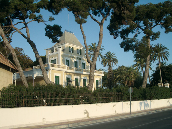
 Beginning of the route.From the Muchavista TRAM stop we will head for El Campello for some metres and then we will turn left into Avenida de Fabraquer (0,20). We will go as far as the traffic lights (0.75) and then we keep straight. We go past Villa Marco on our left (1.06), and old, colonial-style house, refurbished and turned into beautiful gardens (visiting hours: Saturday and Sunday from 10 am to 2 pm). We keep on the left along Camino Real de Villajoyosa (1.14). We ignore the Alicante signpost on the right (1.18) and we keep straight along a narrow asphalted track that leads us between the few olive fields and orchards left in the area.
  Pedanía de Verdegás.We reach a stop signpost (1.74) and we keep straight as far as a roundabout (2.58). We will keep straight in the direction to Sant Joan & Benimagrell. We cross the bridge over the motorway and just after leaving it behind, we take the first on the left (3.47), just before the "Villa de San Juan" hotel. We can stop the distance meter here if we wish to visit the municipality. Otherwise, we shall keep straight along calle Doctor Pérez Mateo as far as a roundabout (3.91), watch out! There we keep riding along the third branch on the right, that is, where the former asylum is.
 Villa Marco.Little after can we see a hermit on the right, dedicated to the Mare de Déu de Loreto (4.10) where, according to a plate, the Virgin cried on that very spot in 1545. A little bit farther we ride past Alicante Psychiatric Hospital. We will arrive at an avenue (4.42) and then take the cycle lane on the right. We can stop the distance meter in the following roundabout to visit Santa Faz. There usually is a street market on Sunday mornings. The route goes on along the cycle lane in the direction to San Vicente de Raspeig. From there on, we will always follow the directions stated in all the roundabouts of this village. The just planted trees will yield a nice shade in some years to those riding around. Just before reaching San Vicente del Raspeig, we go past a roundabout with a fountain in the middle (11.86). We ride again in the direction to San Vicente del Raspeig, to reach soon after the municipal park (12.41), a good place to rest if we wish so. In the roundabout of the park (12.60) we turn left, riding along the cycle lane and following the directions of the Alicante, Valencia & Murcia motorway. We arrive at another roundabout with a fountain (12.93) and we find opposite a CAMPSA pump station. We keep straight ahead according to the directions of the Alcoy, Valencia and Murcia motorway. A little bit farther we will see a yellow signpost showing the name of the village (13.08) where we may stop the distance meter to visit it.
 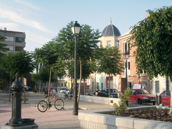 Santa Faz.At the following roundabout (13.22) we keep along the cycle lane, still following the directions of the Alicante, Alcoy, Murcia motorway. We can see in the background the Fire Station tower and Foncalent Mountain. We arrive at a roundabout (13.74) and watch out! We keep on the cycle lane parallel to the motorway leading to Alcoy. We ride under the railway tracks (14.13). At the following roundabout (14.71) we keep riding on the cycle lane under eucalyptus trees leaving the cement factory on the right. We reach another roundabout (14.94) and we keep riding along the cycle lane, parallel to the motorway. The cycle lane ends there and we soon reach another roundabout (16.72), where we will head for Alicante, going under the motorway and then (16.88) in the direction to La Alcoraya & Cañada.
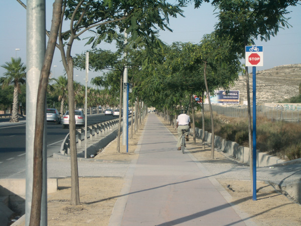 Cycle lane to Sant Joan d’Alacant-San
Vicente del Raspeig.We are to take precautions in the following stage, as it has quite a lot of traffic. We go past the municipal district of Cañada (17.96) and then, past a brick mountain on the right (18.18) where we can have water supply. We leave behind restaurant "El Pintat" (19.14), and farther again we follow the directions of Verdegˆs-Agost (19.71). We arrive in Verdegˆs (20.53) and almost at the end of the municipal district we turn left at the Rodal del Panets or Cami del Saco (20.89). We cross a road (21.23) and we keep on the earth trail, always straight ahead. We leave some houses and some almond tree fields behind. We see an ochre mountain opposite. We always follow the main earth road. We will see some remains of an old waterwheel on the right (22.18) and little after, at the back on the right, a small bridge with a blue handrail. We leave some cement industrial premises on our right (22.90). We ride parallel to the motorway and we take the first path on the right (23.27) to go under the motorway. After the latter, watch out! We ignore the path that leads up the motorway and we keep right on the one leading to a pink house. We then turn right bordering a pool (23.68) to go past a small cement house (24.07) on the left.
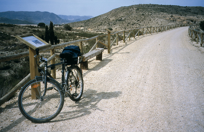 Maigmó Greenway.We always follow the main track, getting oriented towards the mountains opposite and the railway track. We can see soon an old two-storey house with a pine tree garden and the Agost way-station. We arrive at a road (25.10) and little after we ride under the railway tracks (25.43), where we come across the Maigmó Greenway. We keep along it on the left, and some kilometres later, we will reach a brick factory (29.75) to be found at Agost entrance. The route keeps straight ahead along a dirt track, but if we wish to visit the municipality, we can stop the distance meter and have access to it by the road on the right. Once the visit is over, we resume the route from here. We go through the first tunnel (37.46). We then find five more, some of them quite long but in good state. Once leaving behind the last one (43.67), we go across an area with plenty of pine trees at the foot of Maigmó Mount, and on the left, we may see the peak known as "El Balcón de Alicante".
 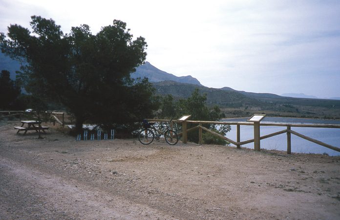 Rest area.We are reaching the end of the Greenway where we can find some tables and benches to have a rest. At the roundabout (46.60) we head for Agost first, and then we take the service track on the right (46.85). The railway track layout is lost, and that is why we can now ride on this service track which is also a cycle-route. Even if this is a lap with little traffic, the lane is shared with cars. After a not-too-long way up, we start a nice way down. We will find a road (48.57) which goes down on the right, but we keep straight. We soon peer at a large depression that makes up the so-called Hoya de Castalla. We can make out Tibi on the right and Castalla in the background.
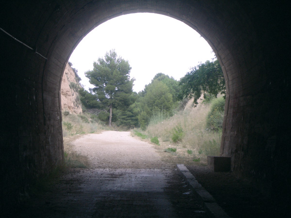 Tunnel on Maigmó Greenway.We leave a road that runs under the motorway on the right and we keep straight (50.20). Now we leave on the left a road that gets narrow (50.46) and that goes up to the Maigmó Mountains and to La Melonera recreational area, which has a camp site managed by the Conseller’a de Territori i Habitatge (phone number: 012). All along this stage can we see the old railway track on the other side of the motorway from time to time (52.91). Little after we enter the municipal territory of Castalla and so, dry-farmed crops such as almond and olive trees start showing up. We leave the main road and we keep on our left along a narrower one where a signpost indicates "cycle-route (54.33). We ride under the motorway once more (54.64) and after the tunnel we follow the asphalted path on the right. Let's ignore a road on the right (56.07) and the path that leads to Castalla. We always follow the main road without getting away from it. We reach a road (57.05). Going left will take us to a rural hotel, "Chorret de Catí". We keep though on the right along itinerary 6. We can make out Castalla's castle in the distance. The landscape in this area is varied, alternating dry-farmed crops, pine tree woods and country houses. We will arrive at a road with a cross (60.01), and we will keep on the right to enter Castalla (60.64) few minutes later.