 Senderos a Pie - Guía de Senderos de pequeño recorrido por la Provincia de Alicante
Short Route Trails / P.R.C.V. 58
 Features
Region: La Marina Alta.
Municipalities: Tormos, Vall de Ebo, Adsubia and Pego.
Responsible Bodies: Centro Excursionista de Pego (Pego Hiking Centre)
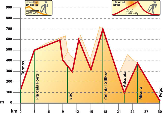
Start: Tormos.
Finish: Pego.
Lenght: 30 kilómetros.
Approximate time: 8 hours 30 minutes.
Difficulty: Medium-High.
Cartography: Benissa 30-32 (822) 1:50.000; Gandia 30-31 (976) 1:50.000.
Services
Adsubia Town Council: Tel. No.: 965 57 13 58
Vall d’Ebo Town Council: Tel. No.: 965 57 14 13
Tormos Town Council: Tel. No.: 965 58 70 41
Pego Town Council: Tel. No.: 965 57 00 11
Tourist Information Office: Tel. No.: 965 57 28 01
Pego Hiking Centre: Tel. No.: 686 09 05 11
Mountain and Climbing Sports Federation (Federació d’Esports de Muntanya i Escalada): Tel. No.: 965 43 97 47
Relief
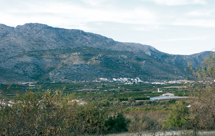
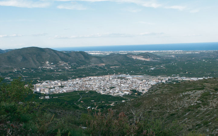
 At the south of the Caroig platform starts the Baetic Valencia territory, which makes up the most oriental peninsular section of the Baetic mountain range. Within this ensemble and in the region of the Marina Alta can we find the lands where this trail develops (PRV 58). They are mountain ranges of jagged relief and basically oriented SO-NE.
Itinerary
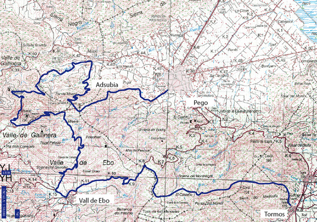
This path starts in the municipality of Tormos, in the direction of the Caval Mountains. From this point, we will head for Vall d’Ebo, leaving past the Gili spring. This trail goes along the gorges of the Xilibre river and the Gallinera castle. From this point, we will go towards Adsubia. Once in the municipality, we will take the way that stems from calle de La Font. We will pass by one of the fountains of Les Mallades and the Pla de Hisera, to finally take the path that will lead us to the Calvario and Pego Avenue.