 Senderos a Pie - Guía de Senderos de pequeño recorrido por la Provincia de Alicante
Short Itinerary Trails / P.R.C.V. 54
 Features
Region: El Baix Segura.
Municipalities: Callosa de Segura, Redován and Cox.
Responsible Body: Club Amigos de la Sierra (Friends of the Mountains Club) and Ayuntamiento de Callosa de Segura (Callosa de Segura Town Council)
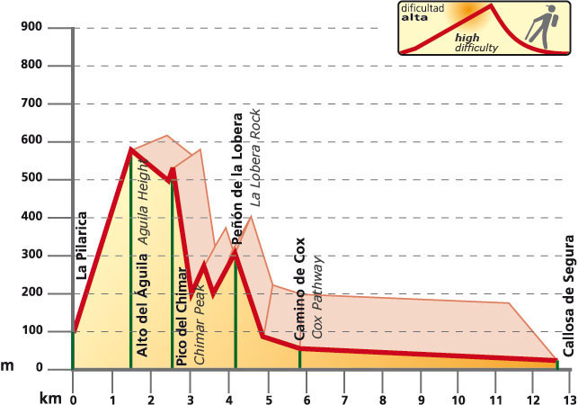
Start: Callosa de Segura (Paraje de la Pilarica).
Finish: Callosa de Segura.
Length: 12.6 kilometres.
Approximate time: 5 hours.
Difficulty: High.
Cartography: 913-II 1:25,000.
Bibliography: Topoguía PRV-54. Ayuntamiento de Callosa de Segura.
Services
Callosa de Segura Town Council: Tel Nos.: 965 31 15 12 / 965 31 05 50
Redován Town Council: Tel No.: 966 75 40 25
Cox Town Council: Tel No.: 965 36 00 00
Cueva de la Ahumada Camp Site (Callosa): Tel. No.: 965 31 03 76
Mountain and Climbing Sports Federation (Federació d’Esports de Muntanya i Escalada): Tel. No.: 965 43 97 47
 Relief
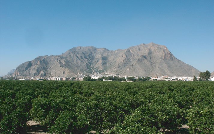
The Callosa Mountains (568 m.) are embedded in the Betic scope. Along with the Orihuela Mountains it makes up a mountainous array consisting of dolomite limestone blocks of the Triassic, emerging in isolation in the middle of an alluvial plain; its shapes are jagged and very fragmented.
Itinerary
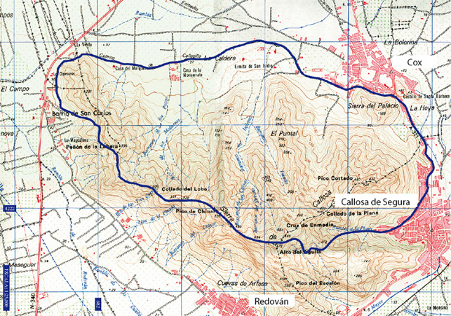
The route starts at La Pilarica Hermitage (Callosa de Segura). We will head for the Alto del Águila and Chinar peak. Having left behind these two milestones, we will reach Lobo hill and the San Carlosneighbourhood. On this location, we will take the road leading to Cox. We will go on from this municipality along the road linking this village with Callosa de Segura, to end up the trail at the La Pilarica Hermitage. This trail consists of two variants.